光学学报, 2019, 39 (11): 1112003, 网络出版: 2019-11-06
基于立体成像机载光电相机的目标定位  下载: 899次
Target Location Based on Stereo Imaging of Airborne Electro-Optical Camera
图 & 表
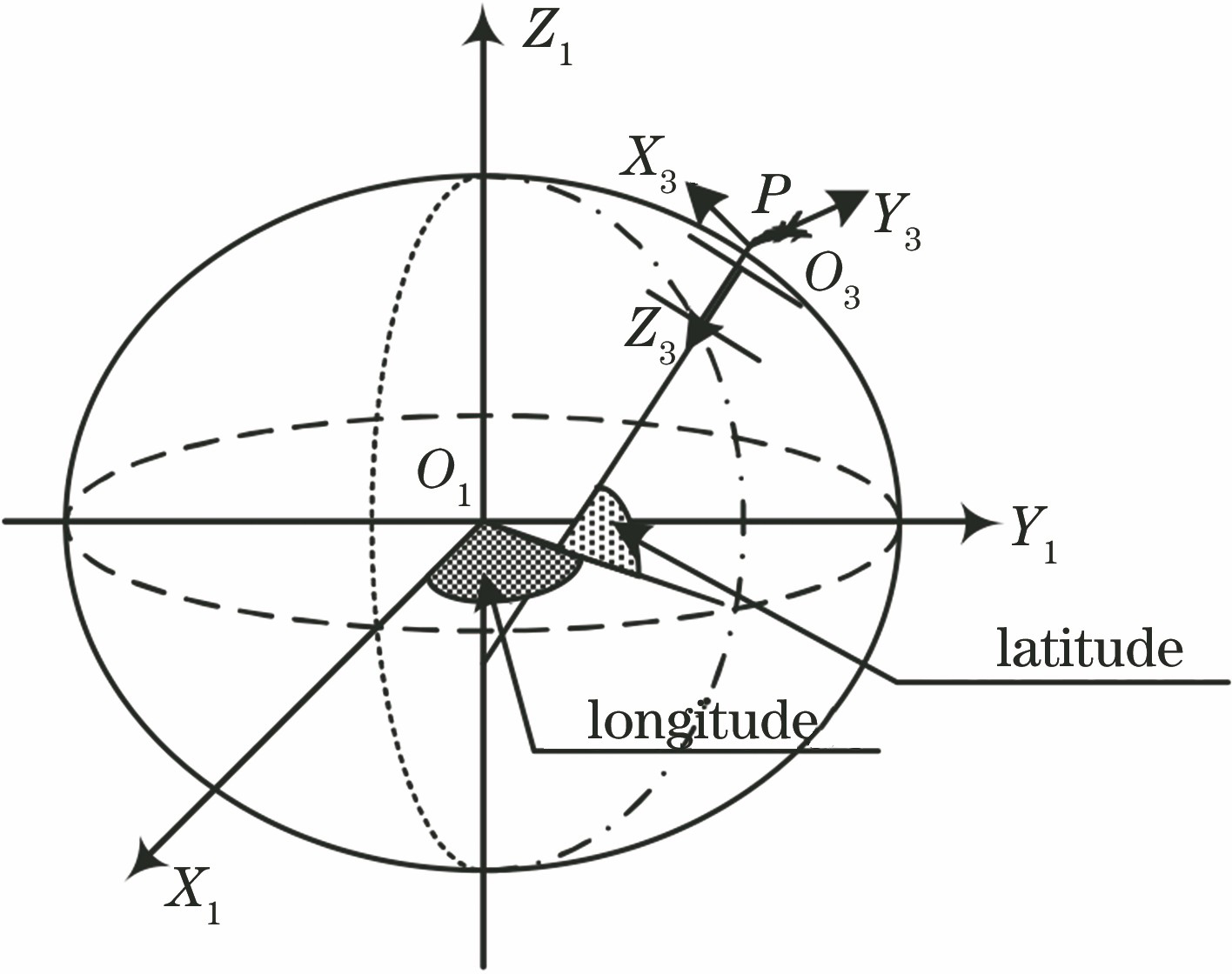
图 2. 地理坐标系和载机坐标系的示意图
Fig. 2. Diagram of geographic coordinate system and aerial carrier coordinate system
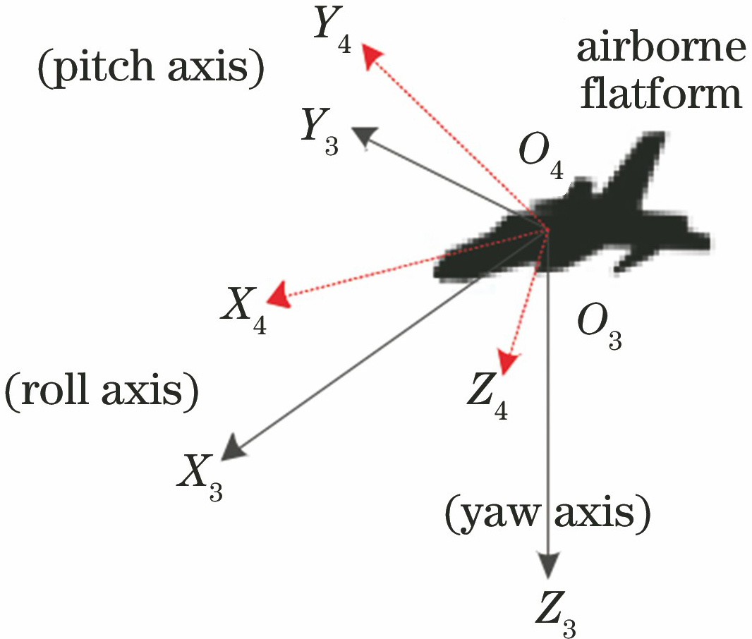
图 7. 目标高度初始随机误差对定位的影响
Fig. 7. Influence of initial random error of target height on geo-location
图 8. 载机高度与目标倾角对定位的影响。(a)在45°倾角时高度变化对定位误差的影响;(b)在10 km高度时倾角变化对定位误差的影响
Fig. 8. Influences of flight height and off-nadir looking angle on geo-location. (a) Geo-location error curves under different flight heights when the off-nadir looking is 45°; (b) geo-location error curves under different off-nadir looking angles when aircraft flies at a geodetic height of 10 km
图 9. 载机高度与目标倾角对定位的影响。(a)倾角为15°~75°时,高度变化对定位误差的影响;(b)高度为5500~14500 m时,倾角变化对定位误差的影响
Fig. 9. Influences of flight height and off-nadir angle on geo-location. (a) Geo-location error curves under different flight heights when the off-nadir angle is changed from 15° to 75°; (b) geo-location error curves under different off-nadir angles when the flight height is changed from 5500 m to 14500 m
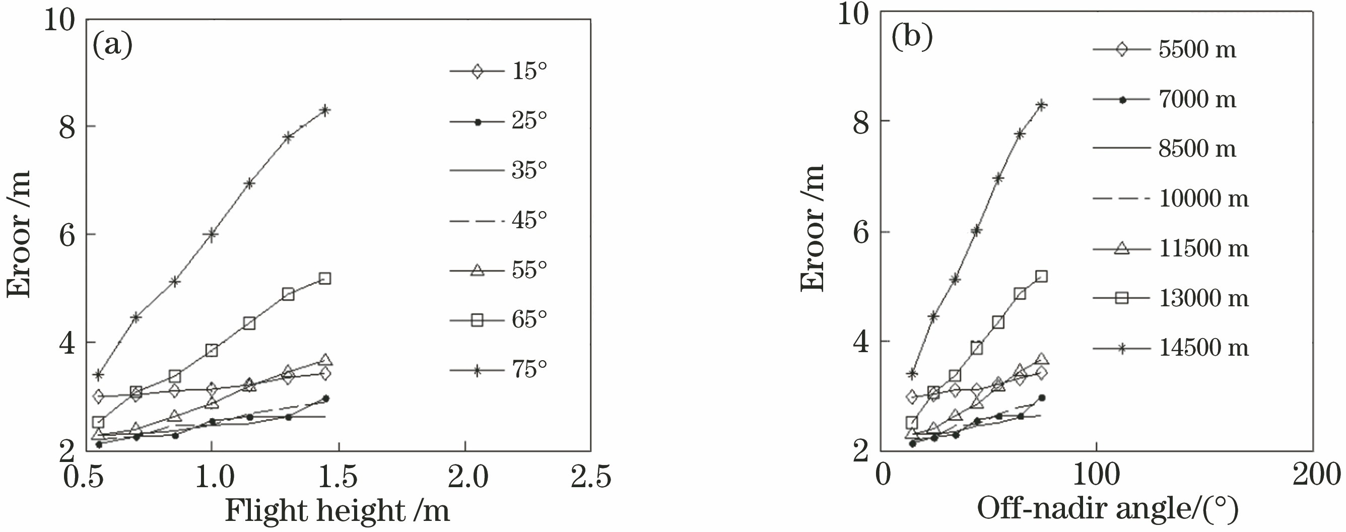
图 10. 两种算法定位CEP仿真结果对比。(a)基于地球椭球模型的仿真数据;(b)本文算法仿真数据
Fig. 10. Comparison of CEP for two algorithms by simulation. (a) Simulated data obtained by Earth ellipsoid model; (b) simulated data obtained by proposed method
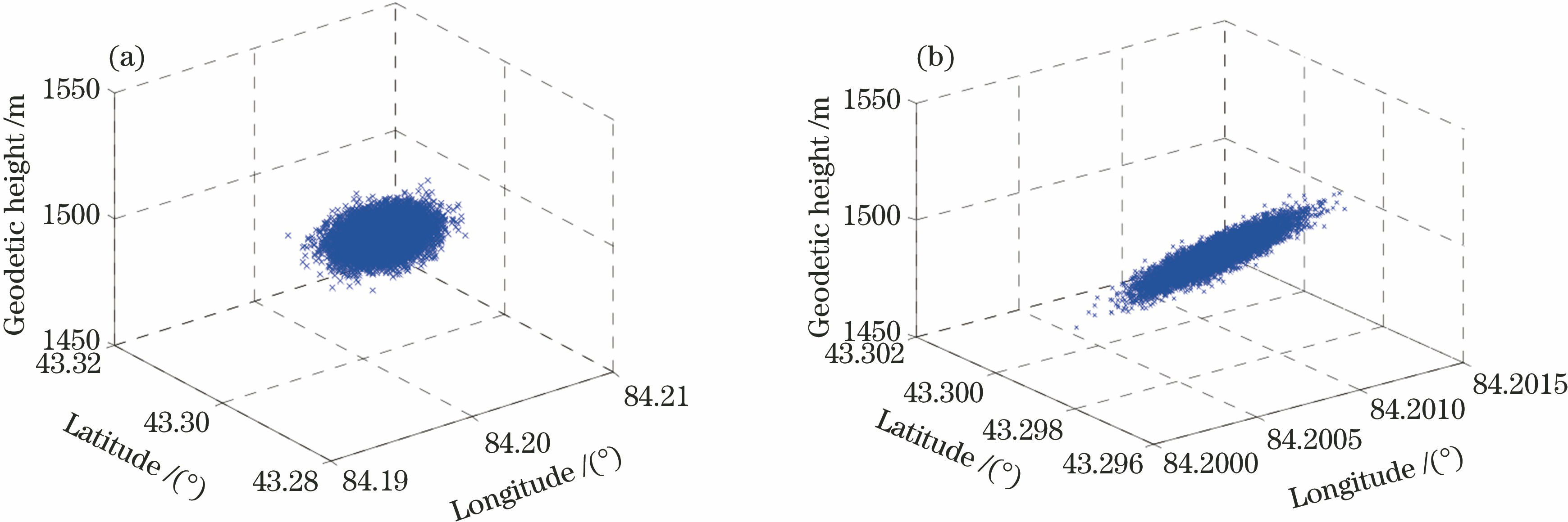
图 12. 不同航点同一目标的8张航拍图像
Fig. 12. Eight aerial remote sensing images of same target at different points
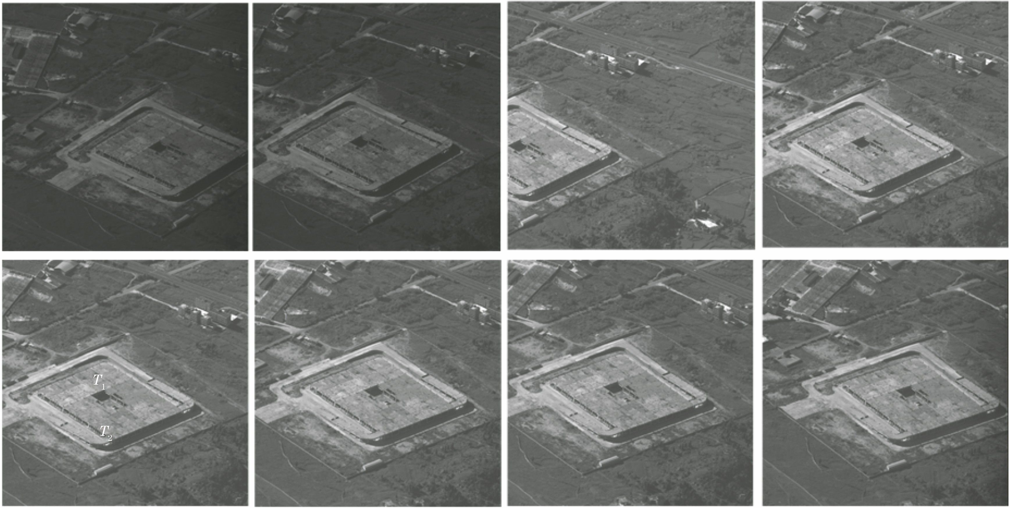
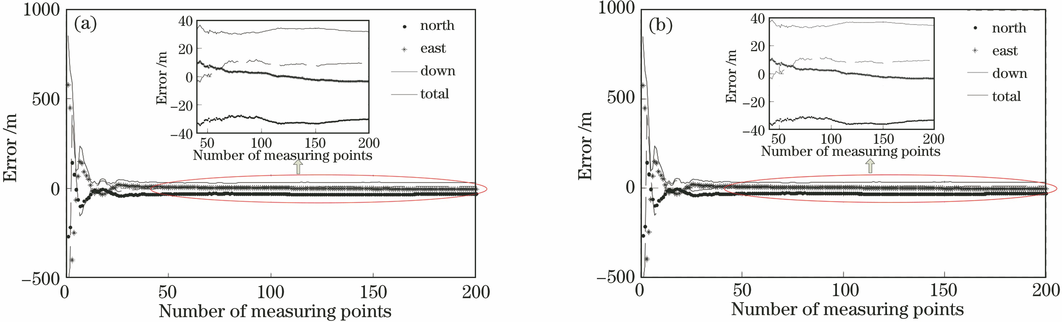
表 1地理定位测量误差
Table1. Measurement error in geo-location
| |||||||||||||||||||||||||||
表 2飞行实验的定位结果
Table2. Positioning results of flight test
| ||||||||||||||||||||||||
刘志明, 张雪菲, 匡海鹏, 李清军, 乔川. 基于立体成像机载光电相机的目标定位[J]. 光学学报, 2019, 39(11): 1112003. Zhiming Liu, Xuefei Zhang, Haipeng Kuang, Qingjun Li, Chuan Qiao. Target Location Based on Stereo Imaging of Airborne Electro-Optical Camera[J]. Acta Optica Sinica, 2019, 39(11): 1112003.


 PDF全文
PDF全文

